A Russian state firm will map more than half of Mali. Who will own the data?
Two contracts signed in Moscow give a Russian state firm the job of mapping Mali’s subsoil and building the system that will hold the data. The accounts published so far do not say who will own it.
On 28 October, at the Russia–Africa summit in Moscow, Mali’s Mines Minister, Amadou Keïta, signed two contracts with Zarubezhgeologia, the foreign-projects arm of the state-owned geological holding Rosgeologia, also known as Rosgeo. The first commissioned geological maps at a scale of 1:200,000 of two areas that together cover more than half of Mali, over 24 months. The second, scheduled for eight months, purchased a national geological information system called “Subsoil Management”.
The mapping includes training for staff of Mali’s National Directorate of Geology and Mines. Reuters, relaying the company’s statement, says the information system is meant to let Mali manage geological data, mineral licensing and regulatory oversight. Other reports describe only spatial storage with tools to visualise and analyse the data.
Bamako’s partnership with Moscow has mostly been read through security, from the arrival of Wagner in late 2021 to the Africa Corps, which has operated under Russia’s Defence Ministry since last year. These contracts reach somewhere else: the records of the Ministry of Mines.
A database beside the cadastre
On 17 April, President Assimi Goïta presented a new cadastre, fully digital and designed by Malian experts, already listing 631 titles and linked to the financial platforms of the Ministry of Mines, the Treasury and the tax directorate. Keïta said the system answered the head of state’s wish that the sector be reclaimed by the Malian state.
ITIE Mali’s description of the cadastre platform, SICAM, says users can apply for titles, follow the processing of their files, pay fees and consult data that includes geological maps. A system designed by a Russian firm will therefore enter an administration that already handles titles and maps digitally.
Titles are moving again, slowly. After a freeze on permit procedures that began in late 2022, the Council of Ministers authorised 24 renewals for gold and lithium between 21 August and 30 September, the Mines Minister said on 22 October. Applications for new titles were still suspended in mid-October. The licensing and oversight functions that Reuters reports for the new system raise a further question: how will a system designed by a Russian firm interact with the existing cadastre, and who will administer the information it holds?
So far, the published accounts leave out the price, the exact boundaries of the two survey areas and any provision on who owns the data once the work is done.
Three questions are easily run together: who owns the maps and the data, who may use the data and on what terms, and who controls the software, its updates and its day-to-day operation. The announced training covers satellite-image interpretation, which builds skill in reading the data, not control of the system. A state can own data it cannot maintain without its contractor, or hold broad rights over a database it does not own.
Mali is building institutions of its own for this. On 30 September, four weeks before the Moscow signing, the Council of Ministers approved draft texts creating a new agency to research, produce, secure and disseminate geological knowledge. It would replace a programme set up in 1990. The mining code already limits what the administration may release: information gathered from title holders stays confidential for the life of the title plus a year, and may not go to third parties for three years without the author’s consent (Articles 121 and 122). That covers company data, not a survey the state commissions, so the new contracts’ terms remain open.
A 1:200,000 map will not tell anyone what a deposit is worth. It shows where to look. New applications are still on hold. When they reopen, Article 29 of the mining code gives an exploration authorisation to the first applicant who qualifies, though state-owned companies have priority. Whoever knows where to look can get there first. A ministry holding the same data can also weigh applications against more than the applicant’s own word.
Mapping first, exploration later
On the day of the signing, Zarubezhgeologia’s director-general, Alexey Desyatkin, described the company’s work elsewhere in Africa. In the Central African Republic it carried out predictive mapping between 2021 and 2023, identified promising zones and is now exploring for gold there. In Chad, satellite analysis was followed by airborne geophysical surveys this summer. In Benin it resumed exploration the day before. He added that the company is ready to sign agreements in Niger to assess hydrocarbons and explore for gold and other precious metals.
Nothing announced so far gives the company exploration rights in Mali, and Desyatkin did not say that exploration would follow. The sequence he described in the Central African Republic, mapping first and exploration after, gives the question of data ownership more weight.
Desyatkin says the Mali project will make information on the country’s mineral resources more accessible and transparent, including for potential investors. Who would have that access, and on what terms, has not been announced.
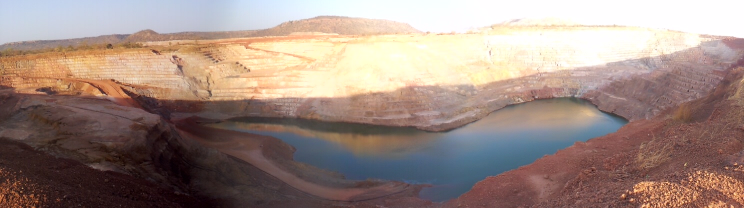
A former open-pit mining site at Sadiola, photographed in February 2013. Photo: IrBoon / Wikimedia Commons / CC BY-SA 3.0.
What Bamako wants from its mines
Since 2023, Mali’s mining code gives the state a free stake of at least 10 percent in a new operating company and an option to buy up to 20 percent more. The company must also cede 5 percent to Malian investors through a state company. State and national participation can therefore reach 35 percent, up from 20. Of that, the state’s own share can reach 30 percent: the free 10 and up to 20 acquired through purchase.
Output suffered during the long dispute with Barrick, which arose as the government demanded higher taxes and a bigger state stake. The Loulo-Gounkoto complex produced 22.5 tonnes of gold in 2024 and 5.5 tonnes in 2025, and Mali’s industrial output fell 22.9 percent to 42.2 tonnes, mainly because Barrick’s operations were suspended for more than six months. The two sides settled in November 2025. In the first half of 2026, industrial output reached 23.5 tonnes, about 30 percent more than a year earlier.
Output is recovering. The latest exploration data, from S&P, cover 2025: a third consecutive annual fall in Mali’s exploration budget, the largest reduction in Africa, at $20 million. A state that wants larger stakes in new projects needs explorers willing to find them, and a good map may be one way to bring them back. What it is worth to Mali depends on the terms on which the state holds it, and those terms have not been announced.
A Russian company is also a partner at the other end of the gold chain. In June 2025 Mali’s National Transition Council approved the shareholding of SOROMA, a company owned 62 percent by the Malian state and the rest by Russia’s Yadran, that is to build a gold refinery near Bamako airport. A map and a refinery do not amount to control of a sector that still runs through Bamako’s licences, taxes and state equity. They would put Russian firms at two of the points where Mali is trying to capture more value.
The information system is due eight months after signing and the maps after 24. By then Mali will have a clearer geological picture of much of its territory. The new agency, charged with securing and disseminating geological knowledge, and the cadastre are where Mali would have to apply three contract terms: who holds title to the maps, who may use them, and who controls the system. If those terms are loose, the agency inherits a map it may be unable to update or release on its own authority.